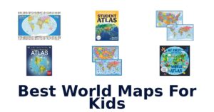
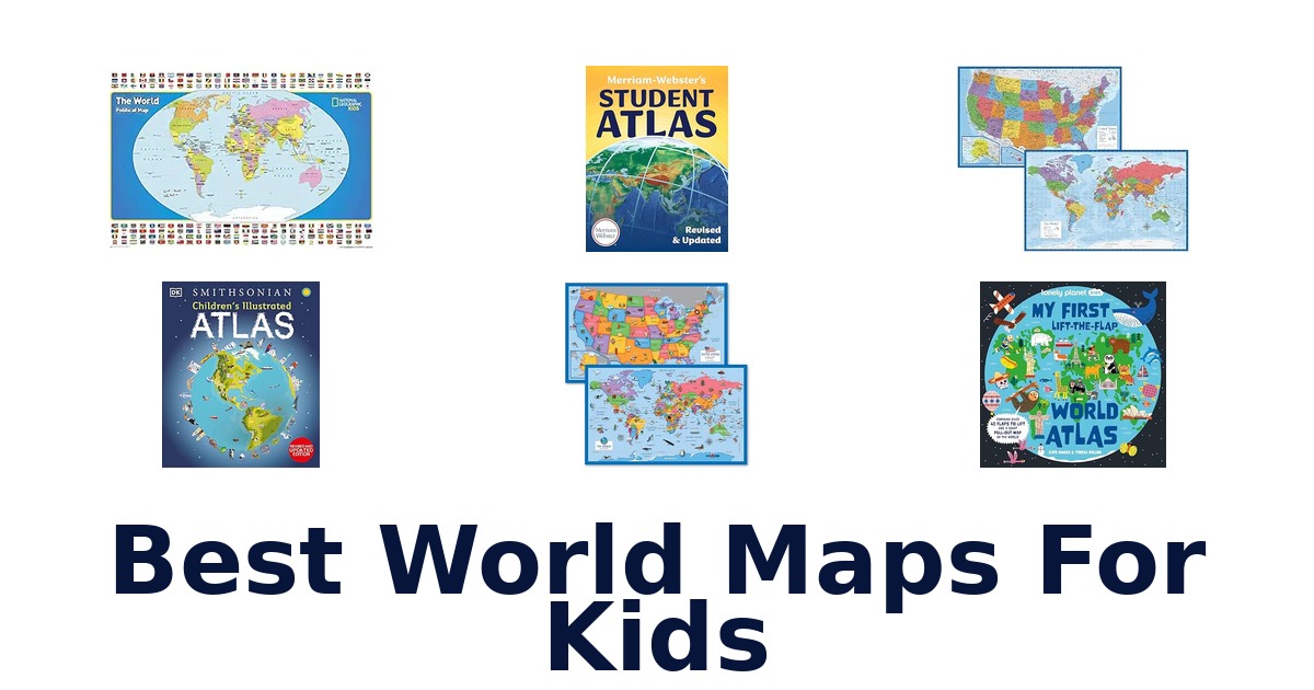
A strong world map for kids makes geography inviting, readable, and suited to where a child will use it, from a bedroom wall to a shared reading session. For a colorful wall display, the Rand McNally Kids’ Illustrated World Wall Map uses color-coded continents and playful illustrations of plants, animals, landmarks, and cultural icons. Families wanting a more durable poster can consider the National Geographic World for Kids Wall Map, which measures 36 x 24 inches and has a laminated finish.
Books offer a different kind of exploration: the Lonely Planet Kids My First Lift-the-Flap World Atlas adds flaps, a pull-out map, and search-and-find games. This roundup compares those formats alongside educational atlases and two-map sets, so you can match the choice to the child and the available space.
The Rand McNally Kids’ Illustrated World Wall Map leads for children who want a visual world map to explore on the wall. Its color-coded continents and illustrations of native plants, animals, landmarks, and cultural icons make the map specifically child-oriented. Choose the National Geographic World for Kids Wall Map instead if a stated 36 x 24-inch size and laminated finish are priorities.
For hands-on reading rather than a wall display, the Lonely Planet Kids My First Lift-the-Flap World Atlas offers flaps, a giant pull-out map, and search-and-find games.
Our Top Picks
 Best Overall
Rand McNally Illustrated Wall Map
Color-coded continents and playful illustrations of plants, animals, landmarks, and cultural icons make this a clearly child-focused world wall map.
View on Amazon Largest Stated Map
National Geographic Kids Wall Map
Its 36 x 24-inch poster size gives the world map a defined display footprint, and plastic gloss lamination increases durability.
View on Amazon Best Laminated Set
Palace Learning Illustrated Map Set
The two 18 x 29-inch posters include illustrated world and USA maps, with 3 MIL lamination and a waterproof edge seal.
View on Amazon- Best Interactive Book Lonely Planet Lift-the-Flap Atlas
- Best for Early Learners Momo & Nashi Classroom Poster Set
Compare the Best World Maps and Atlases for Kids
| # | Product | Buy |
|---|---|---|
| 1 | 1. Rand McNally Illustrated Wall MapBest Overall | View on Amazon |
| 2 | 2. National Geographic Kids Wall MapLargest Stated Map | View on Amazon |
| 3 | 3. Palace Learning Illustrated Map SetBest Laminated Set | View on Amazon |
| 4 |  4. Lonely Planet Lift-the-Flap AtlasBest Interactive Book 4. Lonely Planet Lift-the-Flap AtlasBest Interactive Book | View on Amazon |
| 5 |  5. Momo & Nashi Classroom Poster SetBest for Early Learners 5. Momo & Nashi Classroom Poster SetBest for Early Learners | View on Amazon |
| 6 |  6. Palace Learning World and US SetMess-resistant map pair 6. Palace Learning World and US SetMess-resistant map pair | View on Amazon |
| 7 | 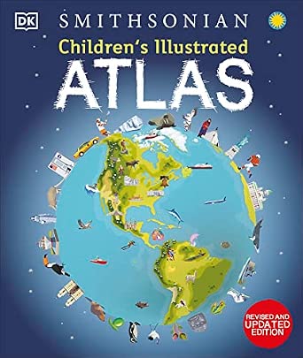 7. DK Children's Illustrated AtlasIllustrated-atlas readers 7. DK Children's Illustrated AtlasIllustrated-atlas readers | View on Amazon |
| 8 |  8. DK Countries of the WorldVisual geography explorers 8. DK Countries of the WorldVisual geography explorers | View on Amazon |
| 9 |  9. Merriam-Webster Student AtlasStudents comparing map types 9. Merriam-Webster Student AtlasStudents comparing map types | View on Amazon |
| 10 |  10. National Geographic Student AtlasStudent atlas users 10. National Geographic Student AtlasStudent atlas users | View on Amazon |
Detailed Reviews: Best World Maps For Kids
#1 · Best Overall
1. Rand McNally Illustrated Wall Map
Best for: Illustrated continent discovery.
Why it ranks #1: Color-coded continents and playful illustrations of plants, animals, landmarks, and cultural icons make this a clearly child-focused world wall map.
Color-coded continents and playful illustrations of native plants, animals, landmarks, and cultural icons give this Rand McNally wall map a child-friendly way to introduce world geography. Its illustrated approach encourages visual discovery across regions, making it distinct from an atlas focused on book-by-book browsing.
Color-coded continents help children distinguish regions at a glance, while illustrations of native plants, animals, landmarks, and cultural icons add points of visual interest across the map. Rand McNally describes the map as intended to spark curiosity in young minds, so it suits exploratory wall display. The supplied format is a rolled paper map, rather than a laminated chart or bound atlas. Since no dimensions or lamination are specified, consider those details if display size or surface protection matters.
- Color-coded continents
- Illustrations of native plants and animals
- Landmarks and cultural icons
- Rolled paper map format
- It is paper, not a laminated map for added surface protection.
Skip it if you need a laminated chart for protection from spills; this Rand McNally map is supplied as rolled paper.
Choose this for children who respond to colorful continent coding and regional illustrations on a world map. Its rolled-paper format makes surface protection and a suitable display method worth considering.
Listed on Amazon as: Rand McNally Kids' Illustrated World Wall Map – Paper Rolled
View on Amazon#2 · Largest Stated Map
2. National Geographic Kids Wall Map
Best for: Durable kids’ wall display.
Why it ranks #2: Its 36 x 24-inch poster size gives the world map a defined display footprint, and plastic gloss lamination increases durability.
Plastic gloss lamination protects this 36-by-24-inch National Geographic kids’ world map, making it a wall-chart choice for families who want added durability. Its poster-size dimensions provide a substantial display, and the map comes from a publisher with a long history of cartography.
At 36 by 24 inches, the map offers a poster-sized world view for a wall rather than a book to carry around. Its high-quality matte poster stock is printed in the USA, while plastic gloss lamination increases durability. That combination supports choosing it as a displayed reference that can withstand more handling than an unlaminated poster. The supplied details do not specify mounting hardware, so plan how to hang it separately if you want it on a wall.
- 36 x 24-inch poster size
- Plastic gloss lamination increases durability
- High-quality matte poster stock
- Printed in the USA
- The map is a wall poster, not a portable atlas for page-by-page browsing.
Skip it if you want a book your child can carry and browse; this laminated poster is sized for wall display.
A fitting pick for families seeking a laminated, poster-size world map for a child’s room or learning space. Consider the 36-by-24-inch dimensions and separate hanging needs before choosing a location.
Listed on Amazon as: National Geographic World for Kids Wall Map – Laminated (Poster Size: 36 x 24 in) (National Geographic Reference Map)
View on Amazon#3 · Best Laminated Set
3. Palace Learning Illustrated Map Set
Best for: Laminated world-and-US charts.
Why it ranks #3: The two 18 x 29-inch posters include illustrated world and USA maps, with 3 MIL lamination and a waterproof edge seal.
Two 18-by-29-inch posters and 3-mil lamination make this Palace Learning set a durable wall-map option for families teaching world and U.S. geography. The matching poster dimensions simplify planning a paired display, while the waterproof edge seal protects against spills and messes.
The set includes world and USA maps, allowing families to display global and U.S. geography side by side. Each poster measures 18 by 29 inches and can be hung with or without a frame, or placed in a matching-size frame. Double-sided lamination, a waterproof edge seal, and tear-resistant construction help the charts withstand handling and spills in a learning space. The two posters still need enough wall area for display, so check the available space before setting them up.
- World and USA map poster set
- 18 x 29 inches per poster
- 3-mil lamination adds durability
- Waterproof edge seal protects against spills and messes
- The pair needs space for two 18-by-29-inch wall charts.
Skip it if you have room for only one chart; this set contains separate world and USA posters, each 18 by 29 inches.
A good match for families wanting a laminated world map and U.S. map in the same size for paired display. Measure the wall first, since both posters need space if used together.
Full product details
| Brand | Palace Learning |
|---|---|
| Color | LAMINATED |
| Item Dimensions L x W | 29"L x 18"W |
| Item Weight | 0.19 kg |
| Manufacturer | Palace Learning |
| Paper Dimensions | 18 x 29 inches |
| Paper Size | 18 x 29 inches |
| Sheet Size | 18 x 29 inches |
Listed on Amazon as: 2 Pack – World & USA Map for Kids [Illustrated] – 2 Poster Set (LAMINATED, 18" x 29")
View on Amazon#4 · Best Interactive Book
4. Lonely Planet Lift-the-Flap Atlas
Best for: Hands-on early map learners.
Why it ranks #4: A board book format adds lift-the-flap exploration, a giant pull-out map, search-and-find games, and engaging illustrations.
A giant pull-out map, lift-the-flap pages, and search-and-find games turn this board-book atlas into an interactive first geography activity. Those features give young readers more ways to engage than simply looking at a map, while the board-book format makes it a book to explore together.
The lift-the-flap format adds a hands-on element as children move through the atlas, and the search-and-find games give them a specific activity while exploring its pages. A giant pull-out map offers a larger view than the book’s regular pages, creating a change of scale within one title. Beautiful illustrations and wow-factor facts and surprises add visual and informational interest. Since the pull-out map is part of a board book, this is an interactive reading choice rather than a wall display.
- Giant pull-out map
- Lift-the-flap pages
- Search-and-find games
- Illustrations, facts, and surprises
- The map is part of a board book, not a standalone wall chart.
Skip it if you need a map to hang permanently in a classroom; this interactive board book is meant to be opened and explored.
Choose this for a young reader who enjoys flaps, games, and a pull-out map during shared or independent browsing. It is less suitable when the priority is a large, continuously visible wall reference.
Listed on Amazon as: Lonely Planet Kids My First Lift-the-Flap World Atlas: Giant Pull Out Map | Wow Factor Facts & Surprises | Search & Find Games | Beautiful & Engaging Illustrations
View on Amazon#5 · Best for Early Learners
5. Momo & Nashi Classroom Poster Set
Best for: Preschool geography starters.
Why it ranks #5: The 24 x 16-inch set pairs a world map with a USA map and artist-drawn icons, and is described for toddlers and early learners.
Artist-drawn icons and colorful details distinguish this Momo & Nashi two-poster set for young children beginning to explore continents, countries, and U.S. states. The world and USA charts measure 24 by 16 inches each, offering early learners two illustrated geography displays for a playroom, classroom, or homeschool space.
The set pairs a world map with a USA map, covering both global geography and U.S. states in one two-poster selection. Artist-drawn icons and colorful presentation make the charts visually engaging for the toddlers and early learners named in the listing. Each poster measures 24 by 16 inches, a compact wall-display size compared with larger charts. The listing identifies the posters as waterproof, a useful feature in child-focused spaces; their dimensions still need to suit the available display area.
- Two-poster world and USA set
- Artist-drawn icons
- Colorful presentation with up-to-date details
- Waterproof feature
- Each 24-by-16-inch poster offers a smaller display area than 18-by-29-inch charts.
Skip it if you want larger 18-by-29-inch charts; each poster here measures 24 by 16 inches.
A fit for preschool classrooms, playrooms, or homeschool settings seeking illustrated world and U.S. maps for early learners. Check that the 24-by-16-inch size suits the space and viewing distance.
Full product details
| Brand | Momo & Nashi |
|---|---|
| Color | USA & World Map |
| Frame Material | Polyvinyl Choride |
| Item Dimensions L x W | 24"L x 16"W |
| Item Weight | 7.36 ounces |
| Manufacturer | Momo & Nashi |
| Material | Plastic |
| Product Style | Modern, Contemporary |
| Size | 24×16 inches |
| Special Features | Waterproof |
Listed on Amazon as: United States & World Map for Kids Classroom Posters – Educational Charts
View on Amazon#6
6. Palace Learning World and US Set
Best for: Mess-resistant map pair.
Why it ranks #6: Two 18 x 29-inch posters pair world and US maps, with 3 MIL lamination and a waterproof edge seal for mess-prone spaces.
This Palace Learning set pairs a world map with a U.S. map, and its 3-mil lamination protects both posters from tears and messes. Each 18-by-29-inch chart can be hung with or without a frame, giving families two wall references without requiring framed posters.
The two-poster set includes both world and U.S. maps, so one purchase provides distinct charts for global and domestic geography. Each poster measures 18 by 29 inches, a consistent size that can be hung with or without a frame or placed in a matching 18-by-29-inch frame. Double-sided lamination and waterproof edge sealing protect the charts from spills and messes, supporting use in busy learning spaces. The laminated surfaces also add tear resistance, though the posters still need a place to hang.
- World and U.S. map poster set
- 18 x 29 inches per poster
- 3-mil lamination adds durability
- Waterproof edge seal helps resist spills and messes
- The 18-by-29-inch posters require wall or frame space for display.
Skip it if you lack space for two wall charts; this set includes both world and U.S. posters at 18 by 29 inches each.
A practical fit for families or classrooms wanting both world and U.S. charts with laminated, mess-resistant surfaces. Make sure there is room to display the pair, framed or unframed.
Full product details
| Brand | Palace Learning |
|---|---|
| Color | Blue |
| Item Dimensions L x W | 18"L x 29"W |
| Manufacturer | Palace Learning |
| Model Number | 2PK-BLUE-USA/WORLD-18×29 |
| Paper Dimensions | 18 x 29 inches |
| Paper Size | 18 x 29 |
| Sheet Size | 18 x 29 |
Listed on Amazon as: Laminated World Map & US Map Poster Set – 18" x 29" – Wall Chart Maps of the World & United States – Made in the USA – (LAMINATED, 18" x 29")
View on Amazon#7
7. DK Children's Illustrated Atlas
Best for: Illustrated-atlas readers.
Why it ranks #7: This revised and updated hardcover illustrated atlas suits children who want a book format, though the supplied details give no map-specific features.
The revised and updated edition pairs an illustrated atlas with a hardcover format, giving children a book-based way to explore world geography. Its illustrations make it a distinct option for families seeking an atlas rather than a wall chart, while the hardcover suits readers who want a bound reference to return to.
This is a hardcover atlas, so it works as a book to open and browse rather than a poster that needs wall space. The title identifies it as illustrated, a feature that can make map exploration more visually engaging for children. Its revised and updated edition label is useful to shoppers comparing editions. The supplied details do not specify page count, map topics, or interactive activities, so buyers seeking those particular features should check the book’s listing before choosing.
- Illustrated atlas format for visual map exploration
- Hardcover binding
- Revised and updated edition
- Book format can be browsed without wall installation
- It is a book, not a wall map for continuous room display.
Skip it if you want a large map to hang and reference across a room; this hardcover is a browsable book instead.
A good match for children who prefer opening an illustrated atlas and exploring it page by page. Choose another format if your main goal is a map that stays visible on a bedroom or classroom wall.
Listed on Amazon as: Children's Illustrated Atlas: Revised and Updated Edition
View on Amazon#8
8. DK Countries of the World
Best for: Visual geography explorers.
Why it ranks #8: The hardcover visual geography encyclopedia focuses on countries of the world, making it a reference-book alternative to a wall map.
A visual world geography encyclopedia gives this DK hardcover a broader focus than a single map, making it suited to children who want to explore countries through pictures. Its hardcover book format supports browsing at a desk or in a reading space, rather than dedicating a wall to a map.
The title identifies this as a visual world geography encyclopedia for kids, which makes it a book-based option for exploring countries rather than just viewing a wall chart. Its “Our World in Pictures” framing signals a visual approach, and the hardcover keeps the reference in a bound format for browsing. The supplied details do not specify particular country entries, map features, or activities, so shoppers looking for a specific feature should check the listing before buying.
- World geography encyclopedia for kids
- Visual “Our World in Pictures” approach
- Hardcover format
- Country-focused scope
- It is an encyclopedia book, not a large wall map for room display.
Skip it if you want a map to hang and consult at a glance; this hardcover encyclopedia is for browsing as a book.
Choose it for children drawn to visual, country-focused geography in a hardcover volume. If your main use is ongoing room display, a poster-style world map will fit that need more directly.
Listed on Amazon as: Countries of the World: A Visual World Geography Encyclopedia for Kids (DK Our World in Pictures)
View on Amazon#9
9. Merriam-Webster Student Atlas
Best for: Students comparing map types.
Why it ranks #9: Full-color physical, political, and thematic maps offer varied atlas content, but the paperback is less suited to wall display.
Full-color physical, political, and thematic maps make this Merriam-Webster student atlas a choice for learners who want more than one kind of geographic view. Its paperback format keeps the maps in a book, letting students turn between map types instead of relying on a single wall display.
Physical, political, and thematic maps offer distinct ways to look at geography, so students can use the atlas to compare different map perspectives. Full-color presentation helps distinguish the maps visually, while the paperback format keeps those views together in a browsable volume. This is a book-based option for study or exploration rather than a poster intended to remain on display. The supplied details do not list page count or specific map coverage, so check the listing if those details matter.
- Physical maps
- Political maps
- Thematic maps
- Full-color presentation in paperback format
- Paperback book format does not provide a single map for continuous wall display.
Skip it if you need one map visible from across a room; this paperback atlas is meant to be opened and browsed.
Suitable for students who want to explore physical, political, and thematic maps in one volume. It is not the right fit if your priority is a large, always-visible world map on a wall.
Listed on Amazon as: Merriam-Webster’s Student Atlas – Features Full-Color Physical, Political, & Thematic Maps
View on Amazon#10
10. National Geographic Student Atlas
Best for: Student atlas users.
Why it ranks #10: This paperback student world atlas provides a book-based option, but the supplied listing gives no child-specific illustrations or wall-map details.
The sixth edition of National Geographic’s Student World Atlas gives learners a student-focused, book-based way to explore world geography. Its paperback format suits browsing and study without requiring wall space, while the edition information helps distinguish it for shoppers seeking a student atlas rather than a children’s poster.
As a student world atlas, this title offers a book format for exploring geography through an atlas rather than a single wall chart. The paperback binding makes it a volume to open and browse, which suits learners who want to work through a book at a desk or carry it between study spaces. National Geographic is the named publisher, and the title specifies the sixth edition. Supplied details do not identify particular map types, page count, or activities.
- Student World Atlas title
- Sixth edition
- Paperback book format
- National Geographic authorship
- Paperback atlas format is not a wall-sized map for room display.
Skip it if you need a single large map to keep visible on a wall; this paperback atlas is a browsable volume.
A reasonable fit for students looking for a National Geographic world atlas in paperback form. Choose a poster instead if the intended use is a persistent room display rather than book-based exploration.
Listed on Amazon as: National Geographic Student World Atlas, 6th Edition (NGK Atlases)
View on AmazonAvoid a wall-map display mismatch
Check the stated map dimensions against the actual wall and any frame before choosing a poster. The National Geographic Kids Wall Map is 36 x 24 inches, while the Palace Learning sets are 18 x 29 inches and Momo & Nashi lists 24 x 16 inches. These different footprints can create a practical mismatch: a map that seems suitable in a product listing may not fit the intended wall or frame.
Palace Learning specifies that its posters fit an 18 x 29-inch frame, while the National Geographic listing gives poster size but no frame compatibility. Also distinguish a wall map from a map book: the Lonely Planet Kids Atlas has a giant pull-out map, but it is a board book with flaps and games, not a stated wall poster.
Measure the display area and decide whether the map must stay mounted or can be brought out for shared reading.
Match map protection to the way it will be used
A laminated poster is the clearest listed option when spills or repeated handling are concerns, but its finish differs from paper map formats. Both Palace Learning sets specify 3 MIL lamination, tear resistance, and a waterproof edge seal; the world-and-US set also says its double-sided lamination protects against rips and stains. National Geographic describes a plastic gloss lamination that increases durability, while its paper is high-quality matte poster stock.
By contrast, the Rand McNally listing identifies a rolled paper map, without a protective finish in the supplied details. That difference can matter in a playroom or classroom where a poster may be touched or exposed to mess.
Do not assume every wall map is wipeable just because it is intended for display: choose a product with an explicitly stated protective finish if that feature matters, or keep a paper map away from spill-prone areas.
How to Choose a World Map for Kids
Wall poster or book format
Choose between a wall display and a book based on how the child will explore geography. The listings span rolled and laminated wall maps, poster sets, and books including the hardcover DK Children’s Illustrated Atlas, paperback Merriam-Webster Student Atlas, and board-book Lonely Planet Kids Atlas. The Lonely Planet title specifically adds lift-the-flap features, a giant pull-out map, and search-and-find games, while the wall maps are designed for display.
A child who likes interactive reading may prefer the board book; a family seeking a map to keep visible can focus on posters. The supplied details do not state ages for every title, so use listed features and format rather than assuming a particular product suits every age.
Dimensions and display space
Compare the listed map dimensions with the wall or frame before ordering. The National Geographic Kids Wall Map measures 36 x 24 inches, the Palace Learning sets are 18 x 29 inches, and Momo & Nashi lists 24 x 16 inches. That range spans a larger single-map display and more compact posters, while the Palace Learning sets include both a world and a US map at the same 18 x 29-inch size.
Buyers with limited wall space may favor the smaller stated dimensions; those wanting a more prominent map can consider the 36 x 24-inch option if the wall accommodates it. Only Palace Learning states a matching frame size, so check frame fit separately for other products.
Finish and intended durability
Look for an explicitly stated protective finish if the map will be handled or displayed where mess is possible. Palace Learning specifies 3 MIL lamination, tear resistance, and a waterproof edge seal; the National Geographic Kids Wall Map says its plastic gloss lamination increases durability. Momo & Nashi lists waterproof as a special feature, while Rand McNally is described as a rolled paper map without a stated laminate.
Families expecting frequent touching or a playroom display may favor the explicitly laminated options. Someone prioritizing the illustrated map itself may instead consider Rand McNally, whose listing highlights color-coded continents and playful graphics, while taking care not to assume unlisted protection.
Which World Map Should You Choose for Your Child?
For a child’s illustrated wall reference, choose the Rand McNally Illustrated Wall Map: its color-coded continents and drawings of plants, animals, landmarks, and cultural icons are directly aimed at young learners. If you want a larger stated poster with a laminated finish, the National Geographic Kids Wall Map is 36 x 24 inches. For a hands-on book, the Lonely Planet Lift-the-Flap Atlas combines a board-book format with a pull-out map and search-and-find games.
Choose the Palace Learning Illustrated Map Set for two illustrated 18 x 29-inch laminated posters, or Momo & Nashi Classroom Poster Set for a smaller 24 x 16-inch world-and-USA pair. For atlas-style reference, consider DK Children’s Illustrated Atlas or Merriam-Webster Student Atlas.
Frequently Asked Questions
What size world map works best on a child’s bedroom wall?
Choose a size that fits the available wall space and can be viewed comfortably from where your child will use it. If a specific dimension matters, check the listing: the National Geographic World for Kids map is stated as 36 x 24 inches, while the illustrated poster sets include 18 x 29-inch options.
Should I choose a laminated map or a paper map for a child?
Choose based on where and how the map will be used. A laminated finish is listed for the National Geographic World for Kids map and some poster sets; the Rand McNally illustrated wall map is paper. Compare those stated formats with your intended display and handling needs, without assuming other durability features.
At what age should a child start using a world atlas?
A child can start when they are curious about places and ready to explore pictures, maps, or simple facts with support. Illustrated atlases and interactive features such as lift-the-flap pages and search-and-find games can offer an inviting starting point. More detailed student atlases may suit children seeking fuller reference material.
What map features can make learning more engaging for children?
Illustrations, color-coded continents, and interactive activities can give children ways to explore beyond place names. The Rand McNally illustrated wall map includes drawings of plants, animals, landmarks, and cultural icons; the Lonely Planet Kids atlas adds flaps, a pull-out map, and search-and-find games. Choose features that match your child’s interests.
Should I choose a wall map or a book atlas?
Choose a wall map for an always-visible reference, and a book atlas for hands-on reading. The illustrated Rand McNally map is a child-oriented wall option, while the Lonely Planet Kids atlas includes flaps, a giant pull-out map, and search-and-find games. Illustrated and student atlases offer book-based reference alternatives.
Final Words
For a child who wants to explore an illustrated map on the wall, the Rand McNally Kids’ Illustrated World Wall Map is the lead choice. Pick the National Geographic World for Kids map when its stated 36 x 24-inch size and laminated finish suit your needs. For interactive reading, choose the Lonely Planet Kids atlas.
For broader reference, compare the illustrated and student atlases, and select a poster set when you want both world and U.S. maps.